The Coastline on an Old Map Is Not a Fixed Line
Read an old coastal map with more care: separate survey choices from shoreline change and avoid treating a drawn edge as an exact boundary.
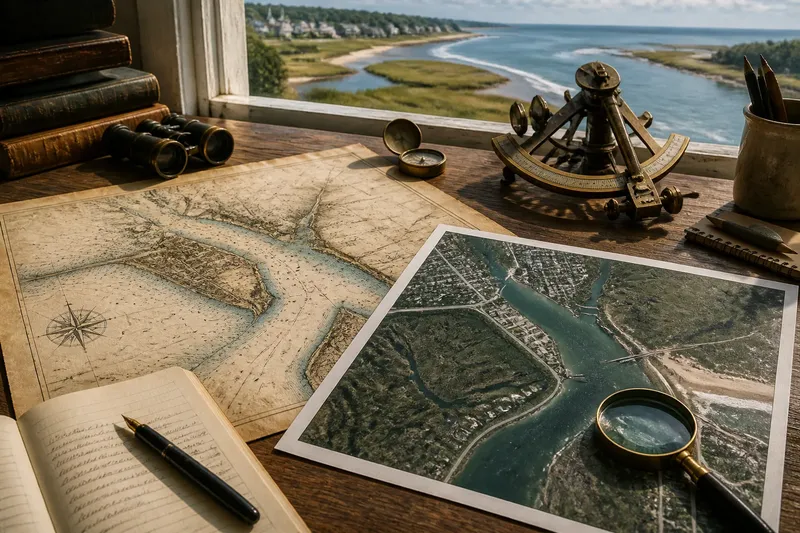
An old coastal map can place a harbor wall, marsh edge, and beach in convincing detail while still showing a shoreline that never existed as one fixed line. To read an old coastal map well, ask how its maker defined, surveyed, and drew the coast before comparing it with the shore today.
Why can one map show several versions of the coast?
“Shoreline” sounds like a simple boundary, but coastal maps may mark different things: the edge of water at a survey’s moment, the high-water reach, a bank, a seawall, or the limit of tidal mud. Those features can sit apart from one another. A mapmaker’s choice may reflect the purpose of the map rather than a claim that one edge is the coast’s only true position.
Survey conditions matter, too. A field team might locate a water edge from a boat, take bearings from landmarks, or trace the shore on foot. Each method gives a different view, and each depends on what could be seen and reached. A marsh obscured by reeds, a steep bank, or a broad flat exposed at low water can complicate the line.
Then comes the drawing itself. A fine original line may become thick when reproduced, while a small-scale chart compresses coves, creeks, and narrow spits into simplified shapes. The line’s apparent precision can exceed the precision of the observations behind it.
What does the map’s purpose tell you?
Imagine a hypothetical harbor town with an old chart made for guiding vessels into a sheltered inlet. Its maker emphasizes the navigable channel, a beacon, and the entrance’s hazards. The marsh margin is sketched loosely, and the beach is reduced to a narrow strip. A later land survey of the same town might instead stress property boundaries, roads, and the bank above the tide.
Neither map has to be careless. Each answers a different question. Before tracing a historical coast, look for the map’s title, legend, scale bar, orientation, and notes about its survey. Check whether it is a navigation chart, land plan, estate map, or general regional map. A legend may distinguish wet ground from open water; a scale bar hints at how much small detail was simplified.
Also notice what is absent. If a map labels a pier but not a tidal creek, that omission does not establish that the creek was missing. The feature may have seemed irrelevant, been hidden during observation, or fallen below the map’s level of detail.
How can you separate drawing choices from real change?
In the imagined harbor town, a reader wants to know whether the marsh has advanced into the inlet. Rather than laying the old map over a current aerial image and trusting the first mismatch, the reader identifies features likely to have stayed put: a church on high ground, a road junction, or a rocky headland. These become reference points for a cautious comparison.
Next, the reader checks what each line represents. The old chart’s edge may be a waterline observed during its survey; the newer map may show a bank or a vegetation boundary. Those lines are not equivalent. The reader can compare like with like where the map legend and visible terrain allow, and mark uncertain stretches instead of forcing a neat match.
Suppose the old chart shows a broad marsh channel but the newer image shows open water across part of the marsh. That difference could reflect erosion or a changed channel, but it could also involve different tidal conditions, a different mapped boundary, or the older chart’s generalization. The useful result is not a dramatic claim; it is a narrower question that can be checked against other records or the place itself.
What should you check before comparing two coastal maps?
- Map purpose: Identify whether the map serves navigation, land ownership, local administration, or another task; interpret its shoreline details accordingly.
- Legend and labels: Find out whether the line marks water, a bank, marsh, beach, or constructed edge; compare only features with compatible meanings.
- Scale and reproduction: Look at the scale bar and line weight; treat narrow inlets and tiny creeks as especially vulnerable to simplification.
- Survey clues: Read notes and symbols for soundings, bearings, landmarks, or field boundaries; use them to understand how the coast was observed.
- Stable reference points: Choose recognizable inland or rocky features that appear on both maps; avoid using a shifting sandbar as the main anchor.
- Uncertainty: Mark stretches where the map’s meaning or location is unclear; do not turn an ambiguous line into a precise boundary.
Which questions help interpret an old coastal map?
Does an old map show the tide line?
Not necessarily. It may show a bank, a conventional chart boundary, or a water edge observed under particular conditions, so consult the legend and survey notes before assigning meaning.
Can I compare a historical map with an aerial image?
Yes, as a visual aid, but first align stable landmarks and account for differences in scale and mapped features. Aerial images also show a moment in time and may reveal a different water or vegetation edge.
Why do old maps omit creeks or marshes?
The feature may have been outside the map’s purpose, too small at its scale, obscured during surveying, or simplified in copying. An omission alone does not show that the feature was absent.
When does a mismatch suggest actual shoreline change?
It becomes more persuasive when comparable features differ consistently across maps and the discrepancy is not explained by scale, survey method, or line meaning. Treat the result as an interpretation to support with additional evidence, not as a conclusion from one overlay.
What can the map tell you at the end?
For the hypothetical harbor town, the careful comparison yields a useful distinction: the chart offers evidence about how the inlet was represented for navigation, while the later image records a different view of the shore. Some changes may be real, but the marsh’s exact former edge remains uncertain until compatible records or field clues clarify it.
That is a sound way to use an old coastal map: read its line as a decision made by a surveyor and mapmaker, then ask what the landscape may have done since. The coastline on an old map is not a fixed line; it is a record with a purpose, a method, and limits that can be read.